Status descriptions:
Developed = Major improvements
Minimal Development = Developed parking area
Undeveloped = No improvements but space for parking
Planned = Not usable as trailhead
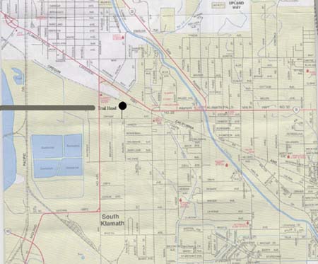
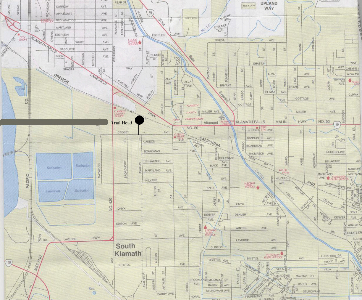
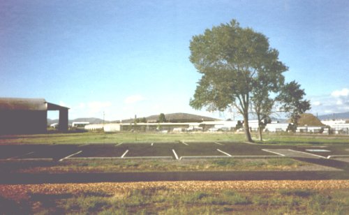
Main Trailhead
. . Status: Developed
. . Parking: Paved, # cars
. . Water: No
. . Restrooms: No
Directions: Klamath Falls, .25 Miles east of Washburn Way on Crosby Ave.
. . . . . . Left turn After self storage facility.
click on map
Hwy. 39 Trailhead
Status: Developed
. . Parking: Paved # cars
. . Water: No
. . Restrooms: No
Directions: East on So 6th (hwy 140/39).
. . . . . .Take right fork at
. . . . . .the hwy140-hwy39 junction
. . . . . .Proceed South on HW 39 abour 4/10 mile.
Pine Grove Trailhead
. . Status: Developed
. . Parking: 11 cars
. . Water: No
. . Restrooms: No
Directions: Klamath Falls Area, 1.6 miles east on Rt. 140 from
. . . . . .intersection of S 6th St and Rt. 140 to Reeder Rd.
. . . . . .Right turn on Reeder Rd .58 miles south parking on left.
Poe Valley Trailhead at Olene
. . Status: Undeveloped
. . Parking: Dirt, Wide Roadside pullout, 10+ cars
. . Water: No
. . Restrooms: No
Directions: Olene area, .60 Miles north of North Poe Valley Rd
on Rt 140
Dairy Turning Y Trailhead
. . Status: Undeveloped
. . Parking: Ballast, Old Railroad siding, 5 cars
. . Water: No
. . Restrooms: No
Directions: Dairy area, .90 Miles east of Dairy on Rt. 140
Dairy BLM Trailhead
. . Status: Undeveloped
. . Parking: Not developed
. . Water: No
. . Restrooms: No
Directions: Dairy area, 1.1 Miles east of Dairy on Rt. 140
. . turn left on Hildebrand Rd. 0.1 miles on left.
Egert Rd. Trailhead
. . Status: Minimal Development
. . Parking: Ballast, graded and compacted area, 5 cars
. . Water: No
. . Restrooms: No
Directions: Hildebrand (old town site) area, 1.27 miles east of Dairy on
. . . . . . Rt. 140E turn left onto Hildebrand Rd. 3.64 miles on
. . . . . . Hildebrand Rd. turn left on Egert Rd. Take Egert Rd for 1.5
. . . . . . miles trailhead is on left (Egert Rd pavement ends at trailhead).
Switchback Trailhead
. . Status: Minimal Development (to be Developed 2003)
. . Parking: Ballast, graded and compacted area, 10+ cars
. . Water: No
. . Restrooms: No (Yes 2003)
. . Camping: On USFS land next to trail (Primitive).
Directions: From Klamath Falls take Rt. 140 east to Dairy (14 miles).
. . . . . .Continue 3 miles past Dairy to Yonna Valley Store. Turn left onto
. . . . . .Squaw Flat Rd. Approximately 12 miles up Squaw Flat Rd. turn left
. . . . . .onto FS #22. Parking is just as you turn onto FS #22. To reach the
. . . . . .Switchback from Chiloquin take Sprague River Rd. east to Sprague
. . . . . .River (25 miles), turn right on Squaw Flat Rd. In 4 miles you will
. . . . . .come to FS #22.
Sprague River Trailhead
. . Status: Planned
. . Parking: # cars
. . Water: No
. . Restrooms: No
. . Directions:
Beatty Trailhead
. . Status: Planned
. . Parking: # cars
. . Water: No
. . Restrooms: No
Directions:
Bly Trailhead
. . Status: Planned (to be developed 2003)
. . Parking:# cars
. . Water: No
. . Restrooms: No
Sycan Shops Trailhead
. . Status: Undeveloped
. . Parking: Ballast, Old Railroad siding, 25+ cars
. . Water: No
. Restrooms: No
Directions: From Klamath Falls take Rt. 140 east 35 miles to Beatty.
. . . . . .For Sycan Siding turn left on Godowa Springs Rd. After 2.1 miles
. . . . . .turn right on Sycan Rd. When the paved road turns to dirt turn right
. . . . . .and continue until the big yellow railroad snowplow.
Horse Glade Trailhead
. . Status: Developed
. . Parking: 20 cars
. . Water: No
. . Restrooms: Yes
. . Camping: Primitive USFS
Directions: Continue on Rt. 140 to Ivory Pine Rd. 15 miles east of
. . . . . .Beatty. Take Ivory Pine Rd north for 12.5 miles and turn left for
. . . . . .Thompson Reservoir (Nat. Forest Rd. 27). You will come to the
. . . . . .railhead in 1.3 miles on the right.
Forest Rd 3207 Trailhead
. . Status: Undeveloped
. . Parking: Ballast, Railbed
. . Water: No
. . Restrooms: No
Directions: Continue on Rt. 140 to Ivory Pine Rd. 15 miles east of
. . . . . . . Beatty. Take Ivory Pine Rd north for 12.5 miles and turn left for
. . . . . . . Thompson Reservoir (Nat. Forest Rd. 27). 11.0 miles on RD. 27 turn
. . . . . . . right on Nat. Forest Rd. 3207. Trail crosses road in 5 miles.
. . . . . . . Park on right along rail bed.
500 Reload Trailhead
. . Status: Undeveloped
. . Parking: Ballast, Old Railroad siding, 50+ cars
. . Water: No
. . Restrooms: No
Directions: Continue on Rt. 140 to Ivory Pine Rd. 15 miles east of
. . . . . . . .Beatty. Take Ivory Pine Rd north for 12.5 miles and turn left for
. . . . . . . .Thompson Reservoir (Nat. Forest Rd. 27). 30.2 miles on RD. 27.
. . . . . . . .Park anywhere on left.
*The OC&E Woods Line State Trail is owned and operated by Oregon Parks and Recreation Department*
Map of the OC&E Woods Line State Trail
Click anywhere along the green line to view a more detailed map of that portion of the trail.
Note that the images tend to load slowly.
 click
click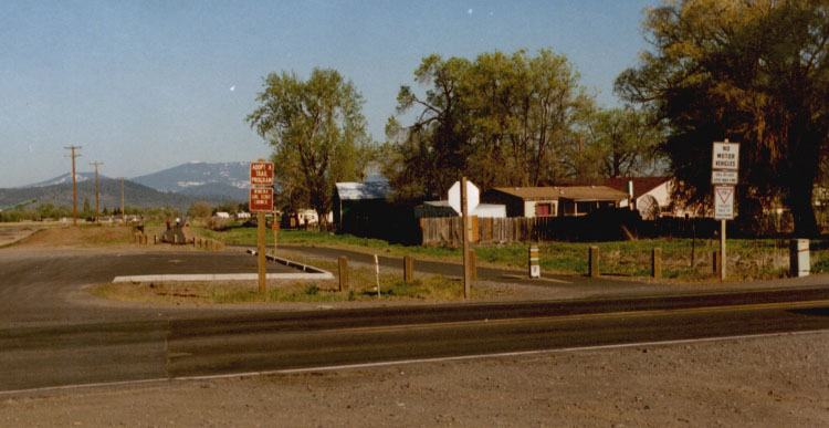 click
click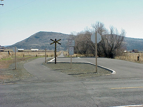 click
click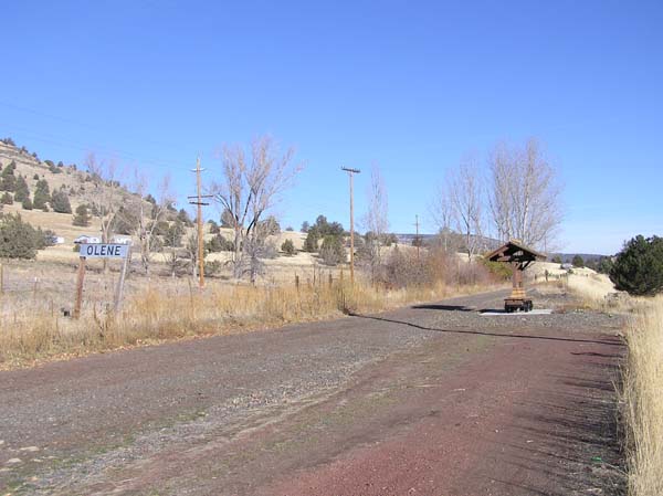 click
click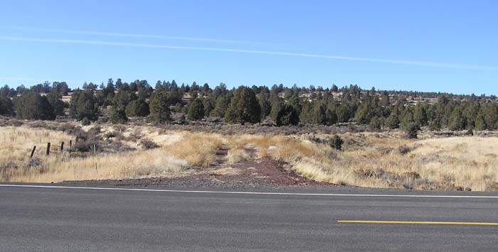 click
click click
click click
click